
The FW3/22 single pillbox is the smallest of the three by Dun Mill Lock. It’s main goal would have been to either as a last ditch attempt to stop invaders if they had breached the FW3/28 pillboxes or to stop hostile forces that may have attacked from the north along the road. It was too small to have held artillery and would have been manned by infantry with machine guns/small arms.
The structure is suffering decay. The steel rebar rod-reinforced bricks of this pillbox seem to now have an ironic effect; the rod structure now seems to be helping the decay of the outer bricks rather than strengthening the structure as was originally intended in its design. This structure is also quite overgrown in places.
It should be noted that some recording of the history of these pillboxes has been made with plaques that were fitted exterior to the FW3/28A twin and the FW3/22 in September 2007 (see: http://www.pillbox-study-group.org.uk/psgwordpress/wp-content/uploads/2013/01/hungerforddunmilllock2.jpg).
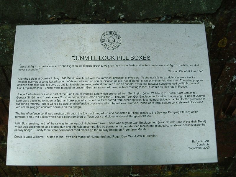
Hungerford’s defences were part of the Blue Line or Ironside Line (named after General Sir Edmund Ironside, Commander of Home Forces in 1940) which stretched from Semington in Wiltshire to Theale. The two anti-tank pillboxes were built to house a two pound anti-tank gun which could be moved between them.
The railway bridge also had two other defensive measures which have long since been removed; square concrete road blocks and vertical, rail-plugged sockets on the bridge.
In 1940, the directorate of Fortifications and Works (FW3) was set up at the War Office under the direction of Major-General G. B. O. Taylor. Its purpose was to provide a number of basic but effective pillbox designs that could be constructed by soldiers and local labour at appropriate defensive locations.
The location of these defences is significant in that they covered a rail bridge and a canal and the approaches to both. Rail lines and canals/rivers were common sites for pillboxes as they were seen to be useful as stop lines against an invading force.
Location
Open the location with: Google Maps | Bing Maps | OpenStreetMap